Himal Race: from Annapurna to Mt. Everest
Ultra trail running race of 1,050 km, Nepal
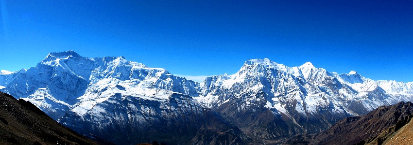
Annapurna Himal (Photo Wikimedia Commons)
The Himal Race Trail
The Himal Race is an extreme running race which starts at the Annapurna Base camp, crosses the Himalayas to finish at the Mt. Everest base camp. The races covers a distance of 1,050 km with 80,000 meters of ascent in 23 days.Because of time constraints, I did only the first 12 stages and stopped at Trisuli Bazar after 605 km and 46,000 meters of ascent. In fact the race is a combination of multiple trekking done back to back: Sanctuary of the Annapurna, Annapurna circuit, Manaslu circuit and Gosinkud trek which are normally done in 60 days.
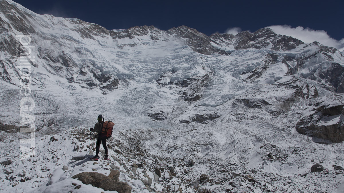
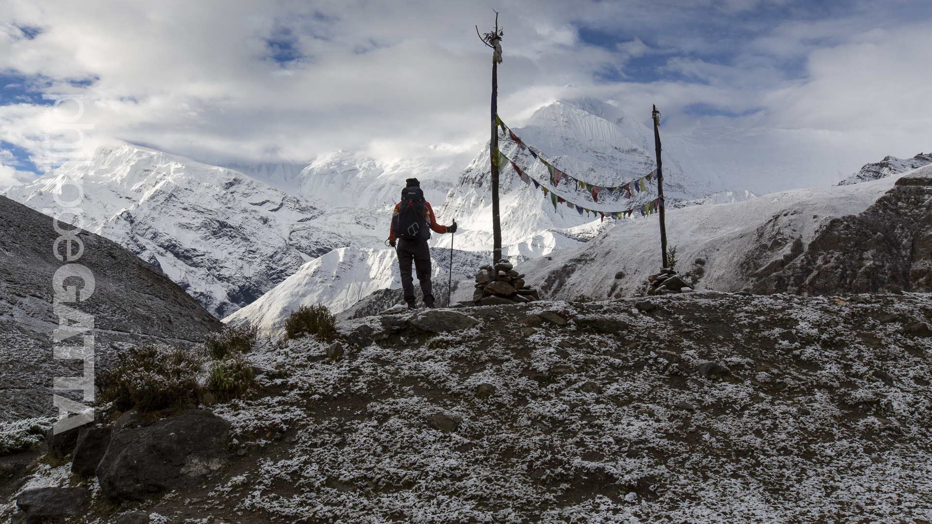
This amazing ultra trail crosses multiples regions, populations, climates and landscapes. We saw a wide variety of sceneries: desert areas (close to the Mustang), high altitude passes, 8000 m peaks, some farms and even some rain forests with monkeys. There are also big difference in the populations; high Tibetan influence in North of Annapurna or Hinduism further South. The impact of tourism is more or less visible depending on the areas; for instance it's very easy to find Coca Cola almost everywhere around Annapurna, whereas the Manaslu region is much wilder and more 'authentic'.
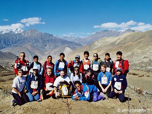
Runners of the Himal Race (© P. Gatta)
The Himal Race regulations
The race regulations are quite simple; a starting point, a finish line, sometimes a check point and a complete freedom to chose our own trail.The race is self sufficient which means each runner must carry all required gear. That includes sleeping bag, clothes, medicine, technical gear (small rope, carabineer, crampons...), energy bars, stove, 3000K calories of survival food, etc. Overall the rucksack weights around 9.5 kg, not including the water.
Himal Race (© P. Gatta)
Climate and weather
The temperatures were not extreme, most of the times between -10ºC and +27ºC but we had big variation each day.
Himal Race (© P. Gatta)
Race organization
The race organization was great with a staff of 60 people who took care of the logistic, race start & finish, check point... Two runners were also doctors and 3 other runners were also rescue expert.
Nepal (© P. Gatta)
Food during the Himal Race
The food during a multi-day race is critical. Unfortunately it's also difficult to have a proper food, with the right balance of carb, protein and fat. The lack of variety in the meal, the limited quantity, the lack of hygiene in some lodges have been challenging.
Sanctuary of Annapurna (© P. Gatta)
Story of the Himal Race 2002
Trek to the Sanctuary of Annapurna (October 28-30)
Naya Pul (1100 m) - Machhapuchhre Base Camp (3800 m)55 km, +4000 m / -1300 m
We spent these three days to trek to the Machhapuchhre base camp to join the start of the Himal Race. This trek was important for the acclimatization but still challenging as we reached the base camp in 2.5 days instead of 6 days of the normal trekking. Three runners skipped this trek and joined directly Tadapani. Anyway, this walk was really nice with a great variety of sceneries from rice fields of Naya Pul, Ghandrung to the forest of Dobang and high peaks.
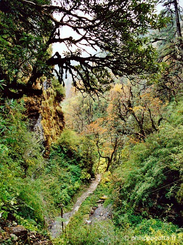
Naya Pul (© P. Gatta)
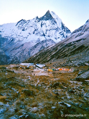
Machhapuchhre (© P. Gatta)
Stage 1 (31 October): Machhapuchhre Base Camp (3700) - Annapurna Base Camp (4100) - Tadapani (2700)\
50 km, +2035 m / - 3050 m, 7h52m4am, we all were excited to start this first stage of the Himal Race, however getting out the sleeping bag was difficult. The temperature was around 3ºC in the lodge and the night 3700 m hasn't been comfortable.
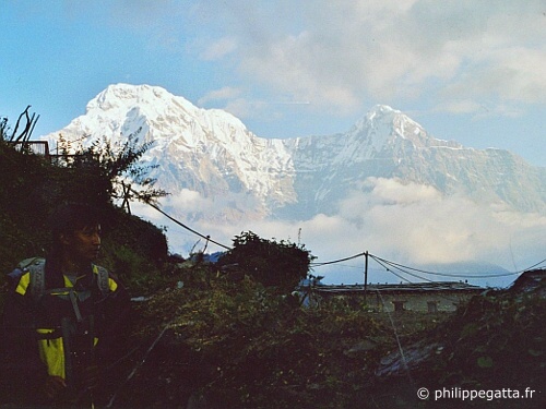
6:30am, we arrived at the Annapurna base camp, the official starting point of the Himal Race. The sun rose over the Annapurna I (8091 m), the Bahara Shikhar (7647 m) and the Machhapuchhre (6993 m).
...and the race started. Despite the 60 km of this stage, the cold, the altitude (4100 m) and the snow on the ground, the pace was closer to a half-marathon than what we could expect on race of 1,000 km!
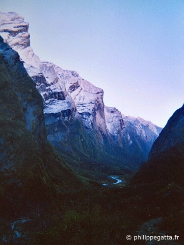
11am, we were back below 2500 m in the vast forest of the Sanctuary of Annapurna. The climb to Chomrong and its +400 m steps was rough. The temperature was over 30ºC, huge change in less than 4h of time.
the last kilometers were beautiful but exhausting. We run down to 1800 m at Chule to go up again to 2700 m. It was hard to believe that we were in a rain forest surrounded by monkeys as we were so close to the glacier of Annapurna a few hours before.
After a good shower we spent the rest of the day to clean up our clothe, stretch, and relax. The first runner completed the stage in 4h52, the last one in 10h48 and one retired.
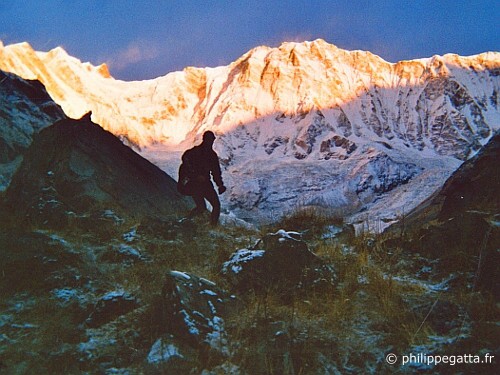
Philippe at the Annapurna base camp (© P. Gatta)
Stage 2 (November 1st): Tadapani (2700 m) - Poon Hill (3200 m) - Dana (1450 m)
40 km, +1460 m / -2535 m, 5h55 mTotal: 90 km, +3495 m / -5580 m
After a few kilometers in the rain forest, we joined the crest between Tadapani and Ghorepani. The weather was great, the temperature pleasant and we could enjoy the view from the Dhaulagari (8167 m) to the Annapurna range. The trail was going up and down before dropping to Ghorepani and finally climbing up to Poon Hill.
We passed the check point at the top of Poon Hill and then went down for 2000 m non-stop. Around noon, Mikael Delonglee, Pasang Sherpa and I thought that we were a few minutes away from the end of the stage. Unfortunately, we mistaken the village of Tatopani and Dana and we had another 6 km and +300 m climb to go. The heat and the 10kg pack made this end of stage painful.
After these long stages of descent, many runners were suffering from their knees and longed for the next 3 days where we went from 1400 m to 5400 m.
Winner: 4h14, last 13h39. Several runners had 4h of penalty because they skipped Poon Hill's climb.
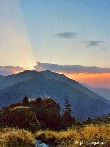
Poon Hill (© P. Gatta)
Stage 3 (November 2): Dana (1450 m) - Marpha (2670 m)
45 km, +1600 m / -305 m, 5h59mTotal: 135 km, +5095 m / -5885 m
We left Dana, its apple and orange trees to return to mineral world of the high altitude. Above Dana the valley was narrower and deeper. The steep trail, devastated every year by the monsoon has to be constantly maintained.
Above Kalopani the scenery became mineral and desertic like in Tibet. At Sokung, I left the trail to take short cut by staying closer to the river. That was shorter but forced me to cross the river many times up to the chest, finally that was not a smart choice. We eventually reached Marpha and met with Anna Gatta who shortened the first stages.
Winner: 4h33, last 9h15.
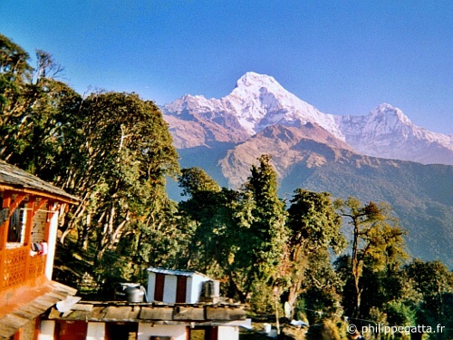
Tadapani (© P. Gatta)
Stage 4 (3 November): Marpha (2670 m) - Kagbeni - Muktinath (3700 m)
25 km, +1115 m / -150 m, 4h05 mTotal: 160 km, +6210 m / -6036 m
Today was the shortest stage of the race. We passed by Kagbeni which was at the extreme North of the Annapurna trek. Further North there is the restricted province of Mustang. Instead we turned toward the East and started the steep climb to Muktinath.
Winner: 2h50, last 6h15.
We spent the 4th of November at Muktinath to rest, acclimatize and do a bit of cleaning.
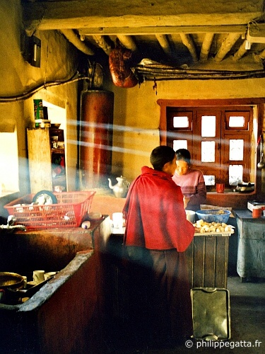
Muktinath (© P. Gatta)
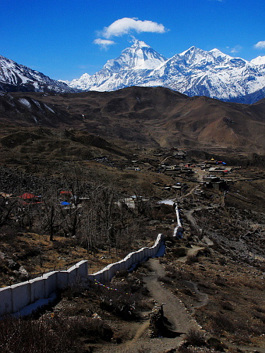
Dhaulagiri from Muktinath (Photo Wikimedia Commons)
Stage 5 (November 5): Muktinath (3700 m) - Thorong La (5416 m) - Khangsar (3800 m)
45 km, +2240 m / -2135 m, 8h37mTotal: 205 km, +8450 m / -8170 m
For some runners today was their first experience of the high altitude. We left Muktinath at 5am to slowly walk to the Col (pass) of Thorong La (5416m). We reached it before 10am where Maryse Dupre and Jean-Marc Wojcik (both runners and doctors) checked our oxygen saturation. Mine was at 67%.
Then we started running toward the village of Khangsar but not for long... above 5000 m, that's too exhausting. I spent most of this stage with Patrick Rolland and Yves Detry, talking about mountaineering while looking at the Annapurna range and Tilicho Peak (7134m) in front of us.
Around noon we crossed the Jhorgeng river and started the climb to a small pass leading to Khangsar. We were happy to see this small village and enjoyed a hot lemon after 8 hours of race.
Winner: 6h36, last 14h. Marie-Jeanne Simons hasn't reached Khangsar and one runner almost had a cerebral edema.
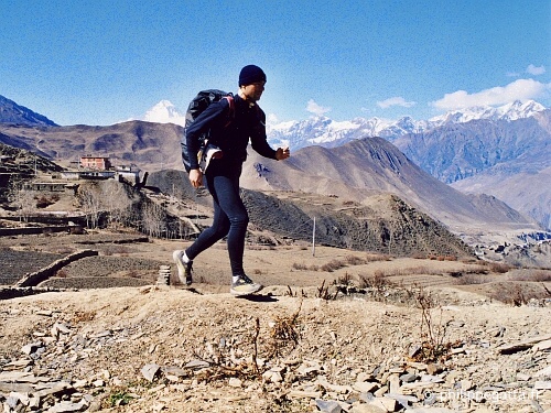
Philippe at Muktinath (© P. Gatta)
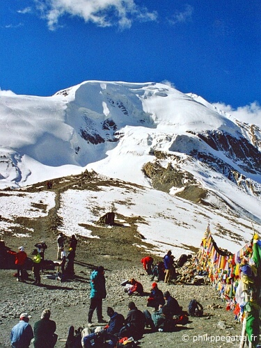
Thorong La (5416m) (© P. Gatta)
Stage 6 (November 6): Khangsar (3800 m) - Tilicho Lake (5100 m) - Manang (3350 m)
40 km, +1955 m / -2405 m, 8h52mTotal: 245 km, +10405 m / -10575 m
We left Khangsar early in the morning to climb toward the Tilicho lake for a new stage over 5000 m. For several kilometers the trail went up and down at around 4000 m, then crossed some sandy slopes before becoming much steeper below the lake. Above 5000 m the trail was covered with snow, the view over the great barrier of Annapurna, the Tilicho lake and the Mesokantu La was fantastic.
I passed the check point and started the descent back to Khangsar. I stopped there for a short while, ate a soup and continued down to Manang.
Winner: 5h35, last 11h. Three runners didn't do this stage and 3 more didn't reach Tilicho.
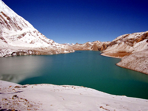
Tilicho Lake (5100 m) (Photo Wikimedia Commons)
Stage 7 (November 7): Manang (3350 m) - Gharyu (3670 m) - Lata Marang (2450 m)
50 km, +820 m / -1910 m, 6h47mTotal: 295 km, +11225 m / -12485 m
After 3 days spent in high altitude we were happy to get back to the forest. We passed Gharyu and quickly reached Pisang and then continued to Lata Marang.
Winner: 4h32, last 9h36. Anna Gatta, Marie-Jeanne Simons and Patrick Rolland left the race and returned to Katmandu while the rest of the runners continued to the Manaslu circuit.
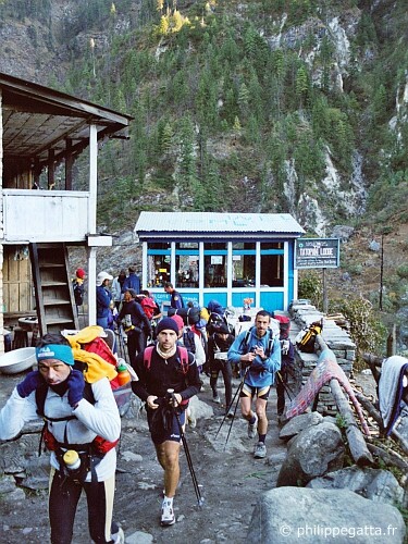
Lata Marang (© P. Gatta)
Stage 8 (November 8): Lata Marang (2450 m) - Dharapani (1950 m) - Bimtang (3800 m)
40 km, +2050 m / -790 m, 6h03mTotal: 335 km, +13275 m / -13265 m
The first part of the race followed a trail in the forest. We left the Annapurna circuit at the check point of Dharapani took the direction of the Manaslu circuit. We started by 2000 meters of climb toward Bimtang. The scenery looked like the Alps except the height of the peaks. The weather deteriorated and forced us to accelerate to reach the lodge before the storm.
The tiny village of Bimtang (3800 m) was made of 3 or 4 broken houses where we spent the night. The 'house' were very rudimentary; 4 simple walls made of stones, a wooden roof and a unique room used both for cooking and sleeping. There was no electricity, no running water, no toilet. The food was stored on the floor with some meat hanging on the wall. We had the feeling that we were a 4 centuries back. Way too tired to be picky, ate everything we could and went to bed. The wind was blowing through the broken walls and it was snowing outside.
Winner: 4h30, last 10h.
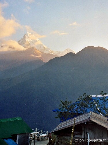
Himal Race (© P. Gatta)
Stage 9 (9 November): Bimtang (3800 m) - Larkya La (5200 m) - Sama Gaon (3500 m)
40 km, +1540 m / -1700 m, 7h31mTotal: 375 km, +14815 m / -14965 m
Because of the fresh snow the race organisation decided to let us walke together to the pass of Larkya La (5200 m) and start the stage from there. We checked again our oxygen saturation at the col (70% for me) and started the descent to Sama Gompa that Gilles Rostollan and I reached 2 hours later. Another 1h30 later we reached Sama Gaon.
Winner: 6h36, last 10h10.
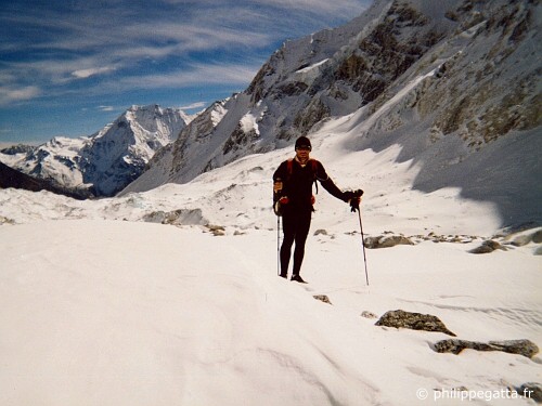
Larkya La (© P. Gatta)
Stage 10 (November 10): Sama Gaon (3500 m) - Jagat (1250 m)
70 km, +1300 m / -3400 m, 9h07mTotal: 445 km, +16115 m / -18365 m
We knew that this 70 km stage would be hard. The sun rose over the Manaslu (8156m) short after the start. This stage started in a nice forest along the river. Then we left the forest follow a steep trail dominating the valley 300 meters below. There were multiples climbs and descents for km and km. The temperature was rising as we were reaching lower altitudes. I joined Emmanuel Villeneuve and helped each other until the end of this demanding stage.
Premier 7h32, last 13h40. Eddy Kern et Philippe Boyer didn't finish the stage.
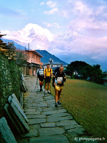
Himal Race (© P. Gatta)
Stage 11 (11 November): Jagat (1250 m) - Arughat Bazar (500 m)
60 km, +1160 m / -1910 m, 6h46mTotal: 505 km, +17275 m / -20275 m
When we woke up the news were not great: Vincent Chautard had a pain on a knee, Pascal Beaury and Francis Faure had many muscle pains we had no news from Eddy Kern and Philippe Boyer who had to sleep somewhere in a tiny village a few km away. This stage was as hard as the previous one with at 60 km to run and a broken bridge half make the river difficult to cross. On top of that we have been told to take care of the Maoist attacks along the way.
30 minutes after the start, the trail was ending and we struggled to find our way and cross the river. I fell in the river and finally managed to cross the river very upset.
Half way the trail splits in two direction. The map was very inaccurate and after several mistakes and extra kilometers I finally found the right trail.
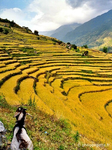
A few kilometers later I passed the broken bridge without much troubles but this stage was endless. I crossed many villages and many rice fields before eventually reaching Arughat Bazar.
Winner: 5h06, last +12h.
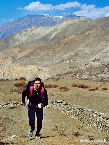
Muktinath (© P. Gatta)
Stage 12 (12 November): Arughat Bazar (500 m) - Trisuli Bazar (540 m)
55 km, +1740 m / -1670 m, 8h30 mTotal: 560 km, +19045 m / -21945 m
We started all together trying to find the good trail leading to Trisuli Bazar. The climate and landscape was completely different from what we had seen so far. It was very hot with 100% humidity and a fog was covering the valley.
While we were walking in the rice fields in the mist, some of us where whistling the Bridge on the River Kwai and Apocalypse Now. Probably excepting the see a bunch of choppers and hearing the Ride of the Valkyries.
A few hours later and 900m higher, I reached the first pass of the day. I thought this stage was flatish but obviously that was not the case.
There were almost no tourist in the area and it was impossible to buy mineral water or soda. To would have been really unsafe to drink the water in the village so I drunk 1.5L in more than 8 hours and I reached Trisuli totally dehydrated.
The curfew started at 7pm, all the roads were empty, the closed and windows locked for this second day of general strike. Despite this tension and fear outside there was a great atmosphere in our group. Maybe too much and while we were a bit too noisy, the military knocked at the door. Thirty of them came in, Kalashnikov in their hands to clear tell us to shut up. We slept in dirty and tiny rooms and the heavy tropical rain falling on the metalic roofs made a crazy noise all night long. That was the perfect condition to relax and recover during an ultra distance race.
As planned the race ended here for Maryse Dupre, 2 other runners and I. Because of the general strike we had to stay at Trisuli Bazar until Nov. 14 Then we came back to Katmandu with a small bus. I'm sad to not be able to continue to Mt. Everest...
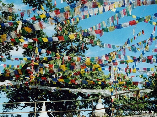
Népal (© P. Gatta)
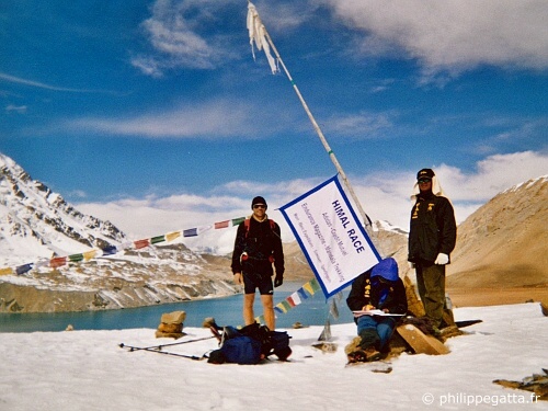
Tilicho Lake (© P. Gatta)
